| |
|  Foto a pagina
10:
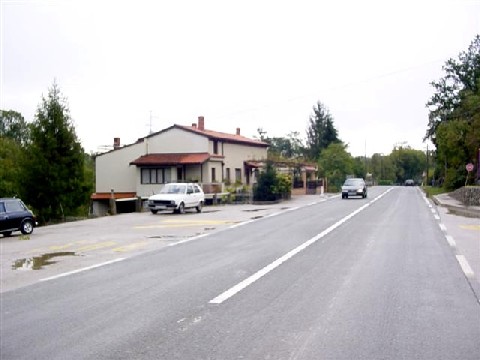
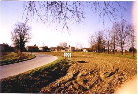
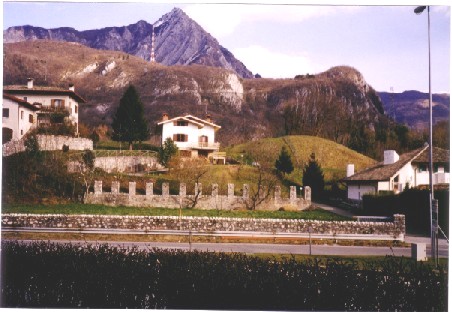
il paese di Permani, sulla strada Trieste - Fiume, a nord di Mattuglie
(oggi Matulji, in Croazia).
Foto a pagina
10:
il paese di Permani, sulla strada Trieste - Fiume, a nord di Mattuglie
(oggi Matulji, in Croazia).
 Photo on page
10: the Permani village, on the road Trieste - Rijeka, north of Mattuglie
(today Matulji, in Croatia).
Photo on page
10: the Permani village, on the road Trieste - Rijeka, north of Mattuglie
(today Matulji, in Croatia).
|
|
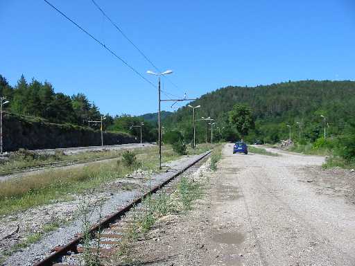
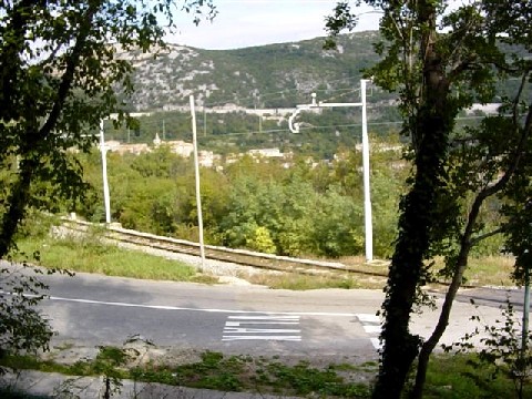
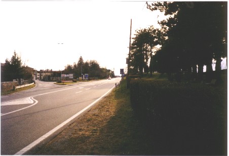
Foto nr. 14:
la foto è stata presa alla stazione di Sappiane (sulla linea ferroviaria
Fiume - San Pietro dal Carso - Trieste; oggi Sapjane, in Slovenia); non
risale al settembre 1943 ma piuttosto al marzo 1944, quando la 3. Pz.Sich.Kp.
venne trasferita da Castelnuovo d'Istria (o Castelnuovo del Carso, oggi
Podgrad) alla zona di Gorizia.
Photo nr. 14:
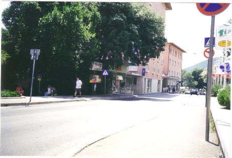
the photo was taken at the Sappiane train station (today Sapiane in Slovenia,
on the railway line Rijeka - Pivka - Trieste); it was not taken in September
1943 but rather in march 1944, when the 3. Pz.Sich.Kp. was transferred from
Castelnuovo d'Istria (also known as Castelnuovo del Carso, today Podgrad) to the Gorizia
area. |
|
|
Foto nr. 18:
Sušak, la parte orientale di Fiume, oltre il fiume Recina.
Photo nr.
18: Sušak, the eastern part of Rijeka, over the Rjecina river.
|
|
|
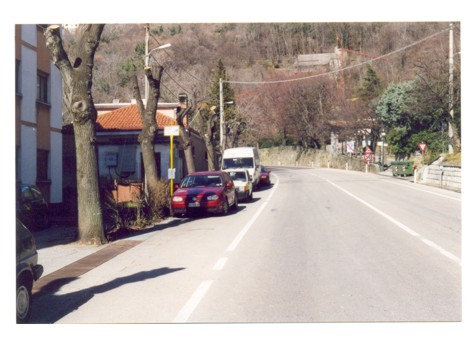
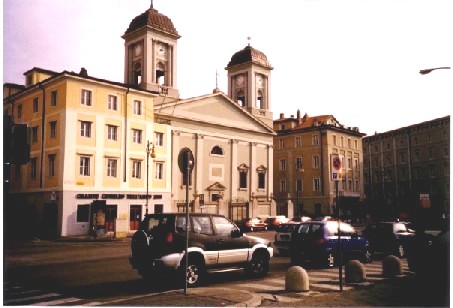
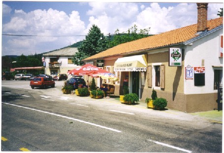
Foto nr. 24:
sulla strada principale di Abbazia (oggi Opatjia, in Croazia) (la foto
è stata presa nello stesso luogo della foto nr. 120); in secondo
piano la chiesa di Sv. Jakov, visibile
sulla seconda foto.
Photo nr.
24: on the main street in Abbazia (today Opatjia, in Croatia) (the photo
was taken in the same place as photo nr. 120); in the background the church
of Sv. Jakov, visible on the second picture. |
|
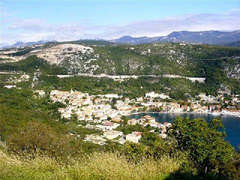
Foto nr. 25-26:
la baia e il paese di Buccari (Bakar) visti dalla ferrovia verso Fiume.
Photo nr. 25-26:
the bay and the town of Buccari (Bakar) as seen from the railway towards
Fiume (Rijeka). |
|
Foto nr. 30:
via Gorghi, Udine.
Photo nr. 30:
Gorghi street, Udine. |
|
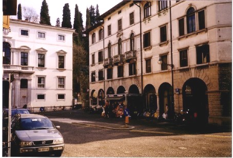
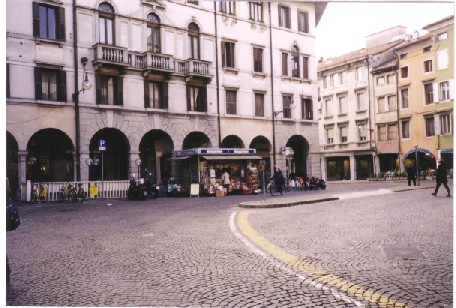
Foto nr. 31-32:
piazzetta Marconi, Udine.
Photo nr. 31-32:
Marconi square, Udine. |
|
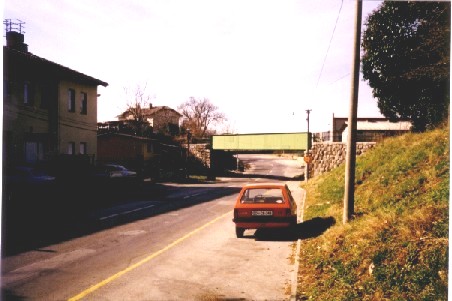
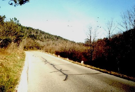
Foto nr. 40:
il paese di Topolza (oggi Topolc, in Slovenia), a nord-ovest di Villa del
Nevoso, sulla strada principale verso San Pietro del Carso.
Photo nr. 40:
the Topolza village (today Topolc, in Slovenia), north west of Ilirska Bistrica,
on the main road towards Pivka. |
|
Foto nr. 41:
Abbazia (oggi Opatjia, in Croazia).
Photo nr. 41:
Abbazia (today Opatjia, in Croatia). |
|
|
|
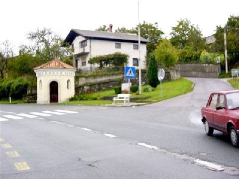
Foto nr. 44:
la chiesa di Castelnuovo d'Istria (o Castelnuovo del Carso, oggi Podgrad,
in Slovenia, sulla strada Trieste - Fiume).
Photo nr.
44: the church of Castelnuovo d'Istria (also known as Castelnuovo del Carso, today
Podgrad, in Slovenia, on the main road Trieste - Rijeka). |
|
Foto nr. 81-84:
l’incrocio poco a sud del paese di Ruppa (oggi Rupa, in Croazia, a
nord di Fiume nei pressi del confine con la Slovenia), dove la strada proveniente
da Fiume si biforca verso Trieste (a ovest) e verso Villa del Nevoso –
Lubiana (a nord).
Photo nr. 81-84:
the junction just south of the village of Ruppa (today Rupa, in Croatia,
north of Rijeka near the present border with Slovenia), where the road from
Rijeka splits towards Trieste (to the west) and towards Ilirska Bistrica
– Ljubljana (to the north). |
|
Foto nr. 85:
alla periferia nord di Mossa (Gorizia), sulla strada verso Preval e il confine
con la Slovenia.
Photo nr. 85:
at the northern edge of Mossa (Gorizia), on the road to Preval and the border
with Slovenia. |
|
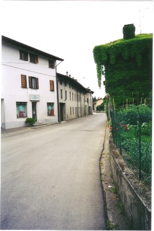
Foto nr. 93:
la strada principale di Mariano del Friuli (Gorizia).
Photo nr. 93:
the main street in Mariano del Friuli (Gorizia). |
|
Foto nr. 118:
il municipio di Venzone (a nord di Udine), ricostruito dopo il terremoto
del 1976 che lo distrusse in gran parte.
Photo nr. 118:
the Venzone (north of Udine) town hall, rebuilt after the 1976 earthquake
that destroyed it almost completely. |
|
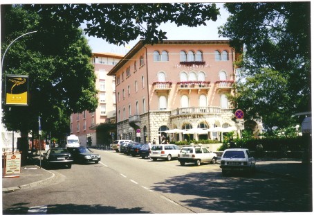
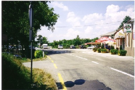
Foto nr. 120:
la strada principale di Abbazia (oggi Opatija, Croazia) (la foto è
presa nello stesso luogo della foto nr. 24).
Photo nr. 120:
the main street in Abbazia (today Opatija, Croatia) (the photo was taken
in the same place as photo nr. 24). |
|
Foto nr. 121:
sulla piazza principale di Abbazia (oggi Opatija, Croatia); l’Hotel
Millennium è la stessa costruzione visibile alla fine della strada
sulla foto nr. 120.
Photo nr. 121:
on the main square in Abbazia (today Opatija, Croatia); the Millennium Hotel
is the same building as seen at the end of the road on photo nr. 120. |
|
Foto nr. 137:
le colline di Vipulzano (oggi Vipolze, in Slovenia), viste dalla strada
proveniente da Mossa.
Photo nr. 137:
the Vipulzano hills (today Vipolze, in Slovenia), seen from the road coming
from Mossa. |
|
Foto nr. 142:
Nimis, la strada verso Udine.
Photo nr. 142:
Nimis, the road towards Udine. |
|
Foto nr. 166:
Salcano (oggi parte di Nova Gorica, in Slovenia), con il ponte ferroviario
della linea Nova Gorica – Bled.
Photo nr.
166: Salcano (today Solkan, part of Nova Gorica, in Slovenia), with the
bridge of the railway line Nova Gorica – Bled.
|
|
Foto nr. 171:
Godia (una frazione alla periferia nord-orientale di Udine), vista dalla
strada proveniente da Salt di Povoletto attraverso il ponte sul torrente
Torre.
Photo nr.
171: Godia (a village at the north-eastern outskirts of Udine), seen from
the road coming from Salt di Povoletto over the bridge on the Torre stream.
|
|
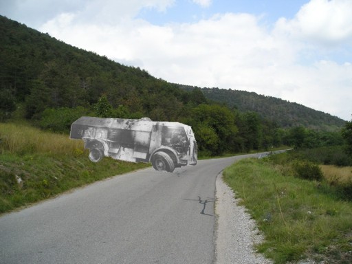
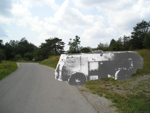
Foto nr. 172-174:
Ospedaletto (frazione alla periferia nord di Gemona). La seconda foto
mostra la statale Pontebbana in direzione di Udine, così come vista
dalla postazione dei P 40 della Karstjäger Pz.Kp., che erano appostati
presso questo incrocio; sulla sinistra il centro di Ospedaletto, sulla
destra l’argine del fiume Tagliamento, che scorre a pochi metri
dalla strada
(si veda anche la foto del P40 e relativa foto comparativa nella sezione
"Nuove fotografie").
Photo nr.
172-174: Ospedaletto (at the northern outskirts of Gemona). The second
photo shown the state road Pontebbana in the direction of Udine, as seen
from the position occupied by the P 40 tanks of the Karstjäger Pz.Kp.,
which were parked at this road junction; on the left is the centre of
Ospedaletto, on the right the bank of the Tagliamento river, which flows
only a few meters from the road (see also the P40 picture and the comparative
photo in the "New photos" section).
|